
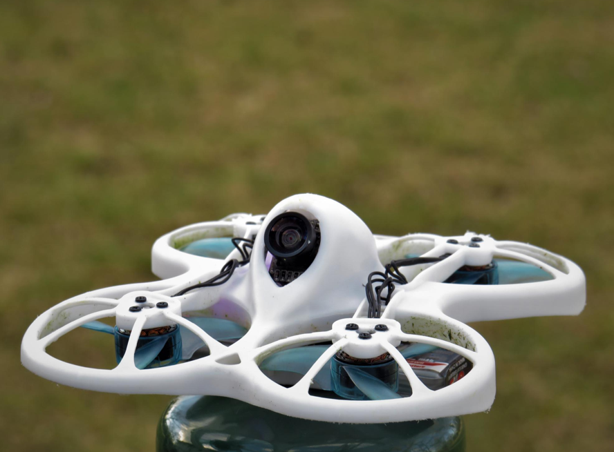
Deploying drone multibeam sonar systems transforms bathymetric surveying across shallow waters and coastal zones. Aerial hydrographic platforms eliminate vessel navigation risks, increase data resolution, cut operational costs, and streamline integration alongside subsurface sensors for comprehensive coastal mapping.
Key Takeaways
- Aerial bathymetry eliminates boat grounding risks in shallow coastal waters.
- High-frequency acoustic swaths capture dense 3D underwater elevation point clouds.
- Remote deployment slashes mobilization expenses compared to manned survey vessels.
- Multi-sensor payloads enable simultaneous bathymetric mapping and subsurface asset detection.
The mapping of shallow coastal waters and inland waterways can present very unique and different challenges for environmental hydrographers. Traditional boat-mounted sounders frequently encounter physical access limits due to dangerous reefs, tidal shoals, and dense aquatic vegetation.
Therefore, the integration of compact bathymetric payloads onto unmanned aerial vehicles will allow survey crews to map hazardous aquatic environments efficiently and safely.
Overcoming Physical Constraints in Shallow Water Mapping
Surveying shallow coastal regions using traditional boat platforms often risks vessel damage or grounding. Aerial bathymetric platforms overcome physical access constraints by sweeping acoustic sensors smoothly above water hazards.
| Survey Parameter | Manned Vessel Multibeam | Drone Multibeam Payload |
| Minimum Depth Limit | 1.0 Meter Draft Requirement | 0.0 Meters (Touchless Airborne) |
| Setup Mobilization | 4 to 8 Hours | 20 to 30 Minutes |
| Daily Area Coverage | Restricted by Vessel Speed | High-Speed Automated Grids |
Table 1: Operational Comparison of Hydrographic Survey Methods
The comparison matrix above highlights the clear operational advantages of aerial hydrographic deployment. Transitioning to autonomous aerial surveying removes traditional vessel draft limits entirely during shallow shore mapping.
Accessing Dangerous and Inaccessible Coastal Zones
Tidal mudflats and rocky shorelines make vessel navigation extremely hazardous for survey crews. Airborne platforms allow operators to deploy acoustic payloads from safe shore stations.
Eliminating Risks in Boat Grounding
Vessels that navigate shallow shoals often risk propeller strikes, and the possibility of structural hull damage increases. Airborne sensors gather precise elevation data while avoiding placing physical vessels in harm’s way.
Mapping Intertidal Zones Efficiently
Tidal shifts leave tiny time windows for collecting shallow elevation data. Drone systems launch rapidly to capture full intertidal areas during brief high-water periods.
Maximising Data Density with Multibeam Swaths
Legacy single-beam sounders gather sparse elevation points directly under the vessel path. Multibeam sonar is used to sweep wide acoustic swaths to capture full 3D terrain models across the seabed.
Capturing High-Resolution Bathymetric Point Clouds
Wide-angle sonar beams map underwater features with millimeter-level spatial detail. Dense elevation grids reveal subtle sediment shifts, submerged structures, and channel erosion patterns accurately.
Eliminating Interpolation Data Gaps
Single-beam surveys require mathematical interpolation to fill wide gaps between flight or boat lines. Continuous multibeam coverage ensures that complete bathymetric datasets are gathered without the need to guess unmeasured depths.
Operational Efficiency and Multi-Sensor Data Integration
Aerial survey operations reduce field crew size requirements and eliminate expensive vessel transport logistics. Advanced mission software enables coordinated multi-sensor surveys across dynamic coastal landscapes.
| Performance Metric | Traditional Survey Vessel | Airborne Hydrographic Drone |
| Field Crew Requirement | 3 to 5 Skilled Technicians | 1 or 2 Certified Remote Pilots |
| Fuel and Maintenance Cost | High Heavy Vessel Expenses | Minimal Battery Charging Costs |
| Data Processing Overhead | Manual Trackline Cleaning | Automated Point Cloud Filtering |
Table 2: Economic and Efficiency Metrics Across Hydrographic Platforms
The performance data table illustrates significant operational cost reductions achieved through aerial surveying. Lower mobilization costs allow survey firms to execute frequent monitoring flights within tight project budgets.
Accelerating Mobilization and Field Workflow Times
Deploying large survey boats requires dedicated marine launch ramps and complex trailer logistics. Lightweight aerial systems pack into standard transit cases for rapid field deployment anywhere.
Rapid Field Deployment Capabilities
Survey crews can set up mission parameters and launch within thirty minutes of arriving on site. Fast deployment accelerates emergency response surveys after major coastal storm events.
Automated Mission Planning Precision
Flight management software automates line spacing, speed, and altitude control for consistent coverage. Precise positioning ensures repeatable survey passes for long-term coastal erosion monitoring.
Combining Bathymetry with Subsurface Sensors
Modern survey projects require evaluating both open water depths and buried infrastructure. Combining a Drone Multibeam sonar platform with an airborne Drone GPR sensor provides a complete view above, below, and beneath the seabed.
Mapping Buried Utilities and Void Spaces
While sonar maps exposed seabed topographies, deploying a Drone GPR detects buried pipelines, cables, and subterranean voids. Using a Drone Multibeam alongside a Drone GPR provides complete structural analysis across coastal transition zones.
Streamlining Dual-Sensor Data Workflows
Integrated survey software merges bathymetric soundings with radar ground reflections smoothly. Combined data workflows lead to the delivery of unified 3D maps that cover both seabed surfaces and sub-bottom geological layers.
Best Practices for Executing Aerial Bathymetric Surveys
Following established flight routines ensures maximum data accuracy and safe field operations. Incorporate these standard operational protocols into your coastal survey planning process:
- Calibrate sound velocity profiles in target water bodies before launching survey missions.
- Establish precise real-time kinematic (RTK) base stations to secure accurate elevation coordinates.
- Monitor surface water turbulence and wind speeds to prevent signal distortion during flights.
- Set safe flight line overlap margins to guarantee complete acoustic swath coverage.
- Audit post-processed point clouds to filter out environmental noise and aquatic vegetation reflections.
See also: How to Convert Teradata SQL to Snowflake SQL Without Breaking Your Data Pipeline
Conclusion
Autonomous aerial platforms unlock inaccessible shallow waters while streamlining multi-sensor workflows. Not only that, by replacing legacy survey methods, these autonomous platforms deliver superior data accuracy, improve accessibility, and simplify multi-sensor workflows.
Upgrade Your Hydrographic Survey Capabilities
Adopting modern aerial mapping tools has completely changed how survey teams capture shallow water and coastal bathymetry. Advanced unmanned platforms make surveys not only more accurate, but also safeguard field crews from marine hazards.
Explore cutting-edge enterprise drone solutions today! Let it elevate your hydrographic survey capabilities.


 Top 5 Qualities to Look For When Hiring Security Guard Services in Bahrain